Aruna Technology Ltd Aruna Technology Ltd
  • Products
    • eBee Drones
    • Garmin GPS
    • Garmin Map
    • GIS Software
    • Satellite Imagery
    • Trimble Survey Equipment
    • Haglöf Forest Inventory Solutions
  • Solutions
    • Forest & Land Cover Mapping
    • GIS Consultancy
    • Land Survey
    • Remote Sensing and Image Processing
    • Training
    • Web GIS
    • REDD and Forest Carbon
  • Who We Are
  • About Us
  • Blog
  • Contact
Jun 10

3D City Modeling in Phnom Penh

  • June 10, 2026
  • No Comments
  • Site News

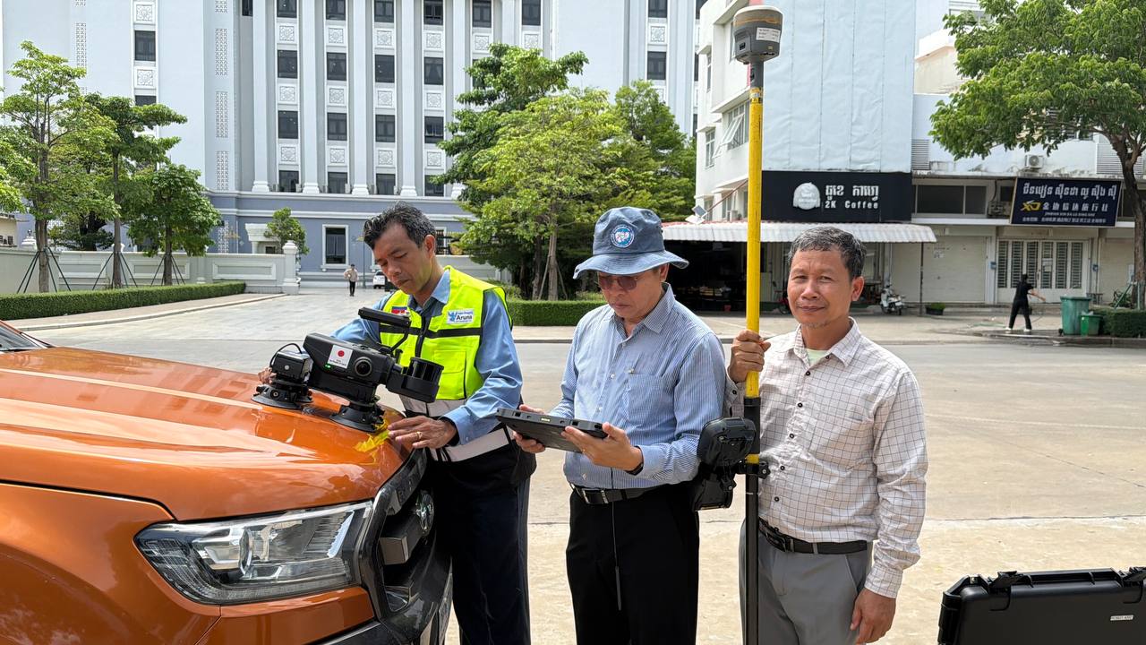
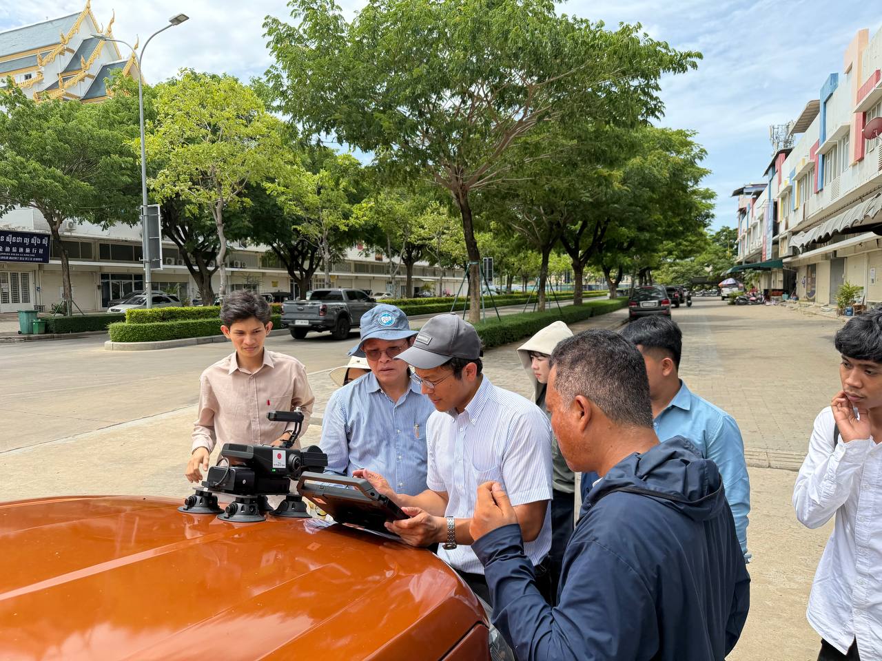
Aruna Technology is proud to be involved in the delivery of training to staff of the Ministry of Land Management, Urban Planning and Construction in the use of 3D laser scanning and mobile mapping technologies.


The training forms part of the Geospatial Data Platform Project, funded by the Government of Japan, which aims to strengthen Cambodia’s capacity to manage and integrate geospatial information in response to rapid urbanisation and support evidence-based urban planning and land management.
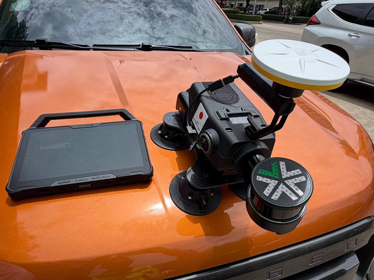
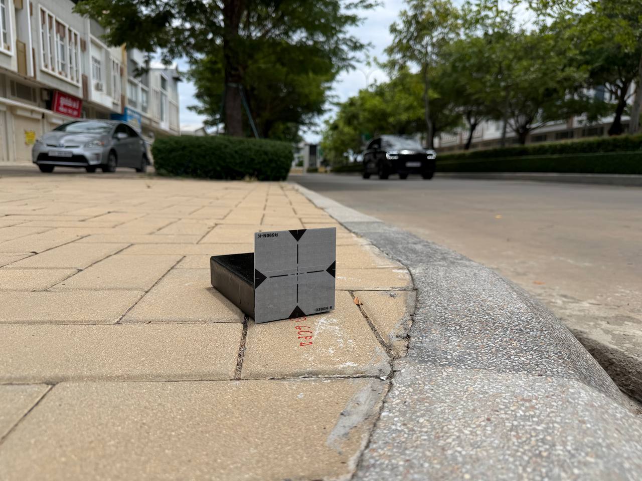
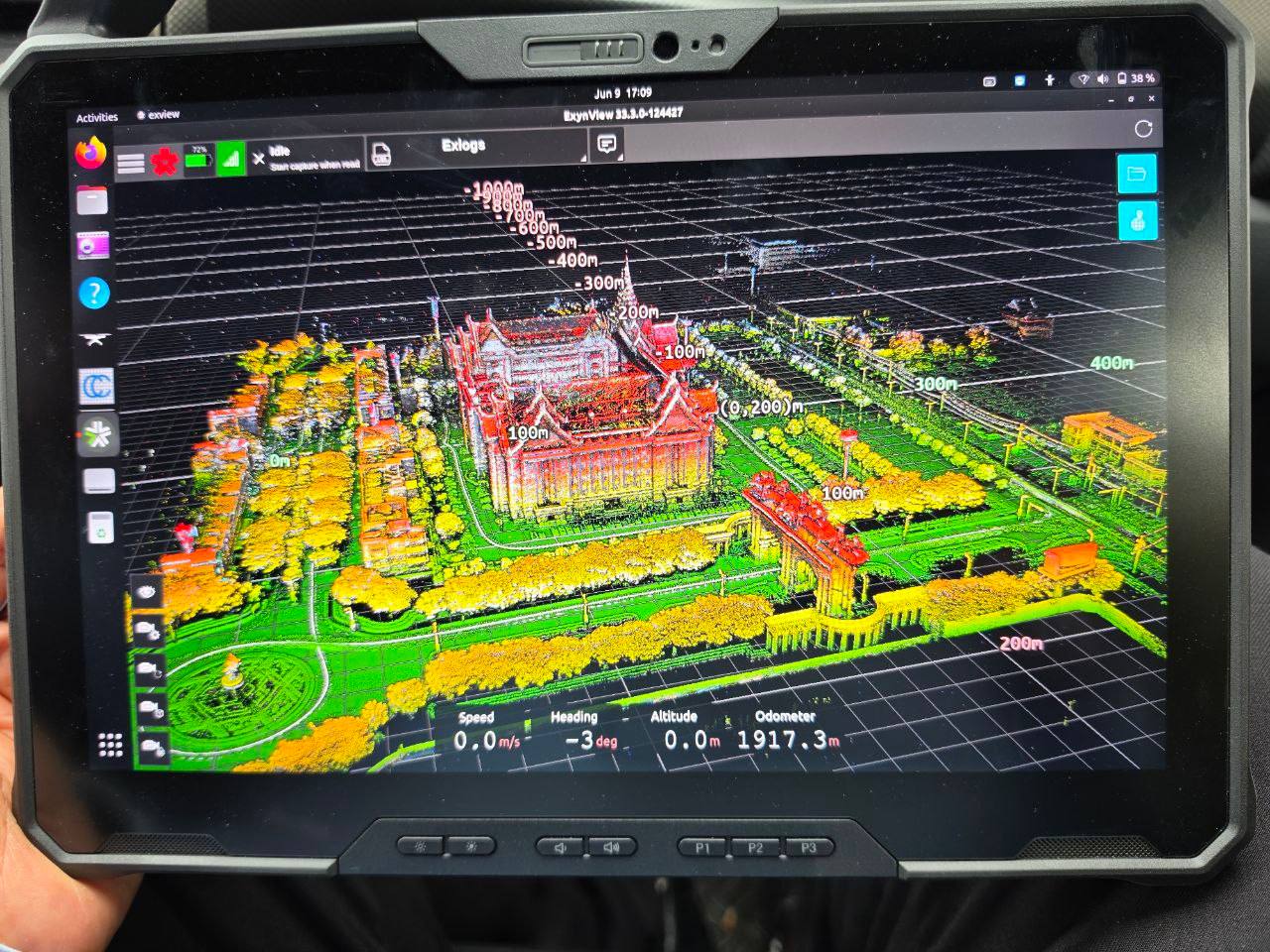
During the training, participants gained practical experience with the Exyn Nexys mobile mapping system, including GNSS control surveys, system configuration, data capture and point cloud visualisation. Mounted on a survey vehicle, the Nexys combines LiDAR, #Trimble DA2 Antenna, cameras and high-precision positioning technology to rapidly capture detailed 3D representations of the urban environment.


The data collected can be used to create highly accurate digital twins of roads, buildings and infrastructure, providing government agencies with a powerful foundation for planning, asset management and future smart-city initiatives.


Supported by a Japanese grant of more than USD 7 million, this important Cambodia–Japan partnership is helping to build the skills, systems and geospatial data infrastructure needed to support Cambodia’s continued economic and social development.

  • Facebook
  • Twitter
  • Reddit
  • Pinterest
  • Google+
  • LinkedIn
  • E-Mail

About The Author

Leave a reply

Your email address will not be published. Required fields are marked *

SEARCH

Archives

  • June 2026
  • May 2026
  • April 2025
  • June 2024
  • April 2020
  • December 2019
  • September 2018
  • March 2014
  • September 2013
  • January 2013
  • December 2012
  • November 2012
  • September 2012
  • August 2012
  • June 2012
  • May 2012
  • April 2012
  • February 2012
  • November 2011
  • October 2011
  • September 2011
  • July 2011
  • June 2011
  • May 2011
  • April 2011
  • February 2011
  • January 2011
  • December 2010
  • November 2010
  • April 2010

Recent Comments

  • sathya LENG on Historical Maps of Phnom Penh
  • Maps of South East Asia | Walking in the Footsteps of Chang Noi on Garmin Map
  • sky on Using Khmer Unicode font with ArcGIS 10
  • Phalla Din on Equipment Donation to RUA
  • Phil on SPOT vs. SRTM DEM Comparison
© Aruna Technology. All rights reserved.