Map Without Limits
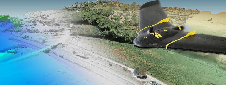
The eBee X is the fixed-wing drone for all your mapping needs. Designed to boost the quality, efficiency and safety of your data collection, it has a camera to suit every job, the accuracy and coverage to meet every project’s requirements, and can work virtually every type of site.
Efficient & Precise
The eBee X can meet the exacting requirements of every project. Its unique Endurance Extension unlocks a maximum flight time of 90 min—for vast coverage of up to 500 ha (1,235 ac) at 400 ft*—while its High- Precision on Demand helps you achieve absolute accuracy of down to 3 cm (1.2 in), without GCPs.
Rugged & Reliable
The eBee X allows you to work virtually every site, no matter how demanding, thanks to its space-friendly Steep Landing technology, ultra-robust design, live air traffic data and more—all backed by senseFly’s trusted professional, local support.
Multi-purpose
The eBee X suits every job thanks to its range of groundbreaking cameras. These include the new senseFly S.O.D.A. 3D, for stunning 3D reconstructions of vertical environments, the best-in-class senseFly Aeria X RGB photogrammetry camera and the senseFly Duet T for creating geo-accurate thermal maps.
Download the Brochure