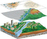
Aruna Technology offers a full suite of GIS consulting services that incorporate the latest technological advancements with professional knowledge and experience. What ever your needs, whether it be natural resource mapping and management, environmental planning, conservation, sustainable development or civil engineering and public works, we can offer you the latest GIS technologies to accomplish your goals.
 In determining your corporate GIS strategy, we will seek to answer the following type of questions to determine if the implementation of a GIS will support your current business objectives:
- What existing mechanisms exist to collect, store and retrieve locational or geographic information?
- What volumes and formats are handled?
- How accurate is the information itself?
- What and where are the barriers to effective information processing and how much do they cost to perpetuate?
- What added-value benefits would GIS deliver?
- What alternatives to GIS could be adopted, how effective might they be and what would they cost?
- Who would be the end users? Where are they and how many of them are there?
- What performance would be required of a GIS in terms of speed of access and response?
- What data volumes would be anticipated? and
- How much existing paper-based archive material would need to be converted into a digital format? How long would this take? What cost would be involved?
Our other GIS services include:
- User requirements analysis and database design
- System customization and integration
- Software application development
- Data acquisition
- Data conversion services
- Database Design and Development
- Digital mapping and cartographic services

