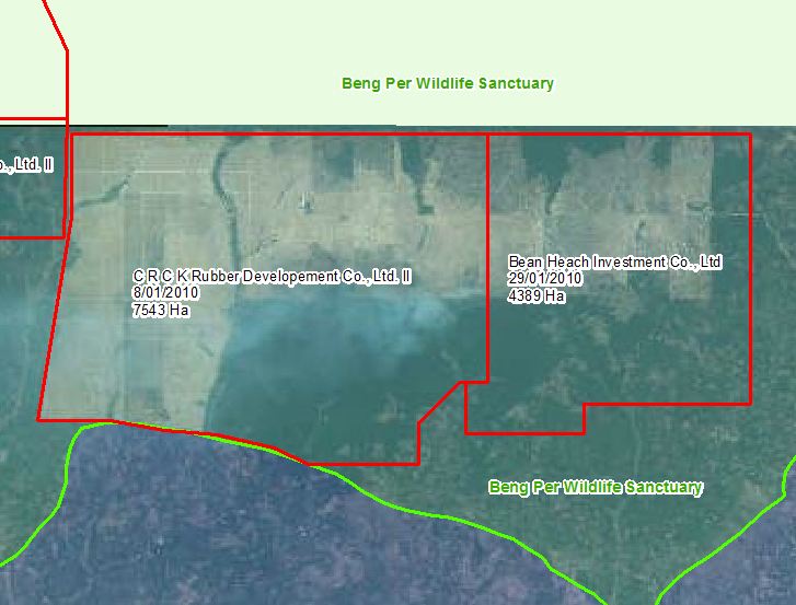
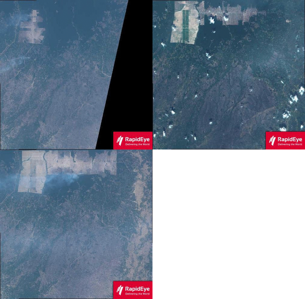
With the advent of newer earth imaging satellites with daily overpass and capture possibilities, it is now even easier to monitor land use change. For example, we can examine the history of development of two Economic Land Concessions (ELCs) inside the Beng Per Wildlife Sanctuary. The concessions were granted in early 2010 and by March 2011, land clearing was well advanced.
If we examine the historical imagery, we can see the incremental clearing that has occurred over 1 year.


Please I am interested to have more news in monthly cloud cover data in Cambodia and also your instruments.
Regards
Benito Acidi