Aruna Technology Ltd Aruna Technology Ltd
  • Products
    • eBee Drones
    • Garmin GPS
    • Garmin Map
    • GIS Software
    • Satellite Imagery
    • Trimble Survey Equipment
    • Haglöf Forest Inventory Solutions
  • Solutions
    • Forest & Land Cover Mapping
    • GIS Consultancy
    • Land Survey
    • Remote Sensing and Image Processing
    • Training
    • Web GIS
    • REDD and Forest Carbon
  • Who We Are
  • About Us
  • Blog
  • Contact
Aug 24

SPOT vs. SRTM DEM Comparison

  • August 24, 2012
  • 1 Comment
  • Site News

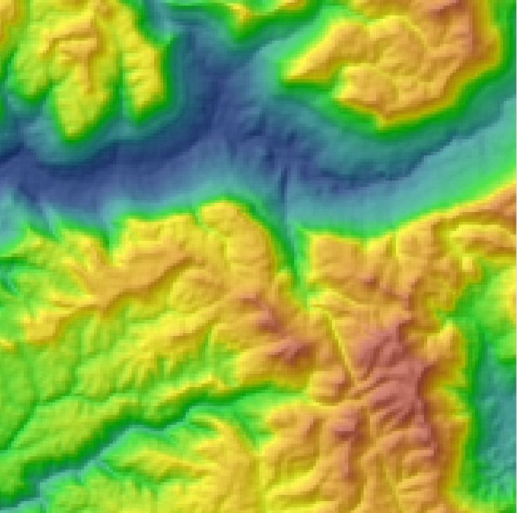
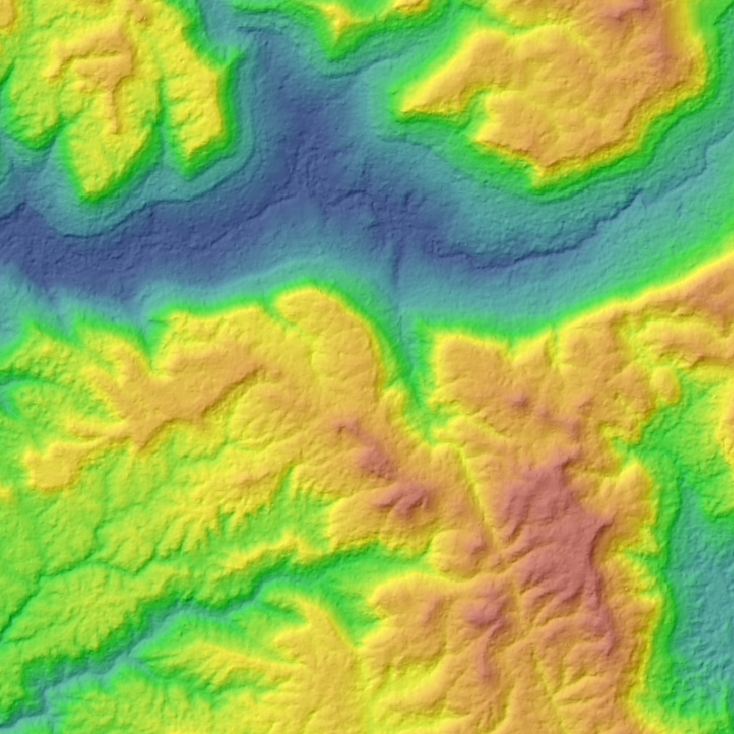
Well I’ve finally manged to get my hands on some SPOT DEM data for Cambodia for a project in the Southern Cardamoms. Quite an improvement over the SRTM (90m) data.  The SPOT DEM has a resolution of 30m at the equator. From Astrium:

A SPOT DEM is a digital elevation model produced by automatic correlation of stereopairs acquired by the HRS instrument on SPOT 5.

Unlike a digital terrain model (DTM), which describes the distribution of terrain or “bare earth” heights, a DEM includes “first surface” elevations including vegetation and man-made structures.

SRTM DEM Detail. Scale approx 1:75,000

SPOT DEM Detail. Scale Approx. 1:75,000

For more info see http://www.astrium-geo.com/en/2790-elevation30-dem-spot-dem or please Contact Us

  • Facebook
  • Twitter
  • Reddit
  • Pinterest
  • Google+
  • LinkedIn
  • E-Mail

About The Author

1 Comment

  1. Phil
    December 4, 2014 at 1:07 am ·

    Would be highly interested in that data-set for a casual project, any ideas how “an indie developer” could get ahold of a copy for non-commercial/”no resale/reproduction” usage?

Leave a reply

Your email address will not be published. Required fields are marked *

SEARCH

Archives

  • April 2025
  • June 2024
  • April 2020
  • December 2019
  • September 2018
  • March 2014
  • September 2013
  • January 2013
  • December 2012
  • November 2012
  • September 2012
  • August 2012
  • June 2012
  • May 2012
  • April 2012
  • February 2012
  • November 2011
  • October 2011
  • September 2011
  • July 2011
  • June 2011
  • May 2011
  • April 2011
  • February 2011
  • January 2011
  • December 2010
  • November 2010
  • April 2010

Recent Comments

  • sathya LENG on Historical Maps of Phnom Penh
  • Maps of South East Asia | Walking in the Footsteps of Chang Noi on Garmin Map
  • sky on Using Khmer Unicode font with ArcGIS 10
  • Phalla Din on Equipment Donation to RUA
  • Phil on SPOT vs. SRTM DEM Comparison
© Aruna Technology. All rights reserved.