Aruna Technology has extensive experience in Forest and Land Cover mapping using satellite imagery and specialised software such as eCognition and PCI Geomatics. We are at the fore of forest cover assessment for REDD and VCS in Cambodia and Laos and are involved in a number of ongoing projects.
By combining international best practice, participatory community planning and the latest in technology and sensors, our approach to forest and land use mapping will ensure that your project has the maximum chance of success, whether it is a community forestry area or “wall to wall” Carbon Accounting.
Please Contact Us for more information on the services that we offer.

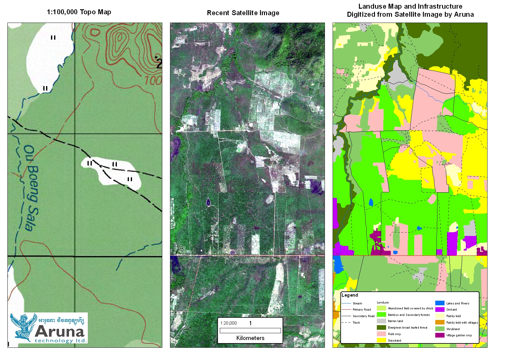
Land Use mapping from recent satellite imagery. In this example an up to date land cover map has been prepared from recent satellite imagery by Aruna Technology. The improvements over existing maps are quite obvious.
Some of our recent projects include:
Rapid Assessment of Prey Long Forest
East-West Management Institute (EWMI) is establishing a Biodiversity Public-Private Sector Alliance with the objective of conserving one of the most important areas of
biodiversity in Asia that is under serious threat, Prey Lang Forest. As a first step in this process, EWMI seeks to better establish the economic value of the Prey Lang Forest and its surrounding areas. Aruna Technology was engaged to conduct a rapid assessment only, the goal of which is to provide a basis for initial estimation of economic values for Prey Lang Forest and its environs as well as the negative effects that would be incurred for the proposed hydropower, mining, industrial and agricultural concessions. The specific services provided by Aruna included:
- Prepare a current, accurate medium-scale and accurate image map of the study area from new satellite imagery to serve as a reference for the project;
- Acquire and geo-reference a time series of archived satellite images and analyze forest cover change;
- Undertake a basic classification of the new satellite imagery to provide the current boundaries of the different zones in Prey Lang Forest and the surrounding region;
- Prepare GIS analysis of the surrounding region to support a brief examination and discussion of the issues of hydrology, carbon markets, infrastructure and potential development and its impacts on Prey Lang Forest.
Forest Cover Change Detection 1990 – 2005, Koh Kong Province

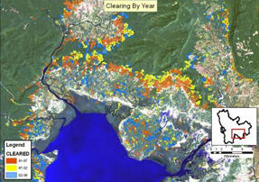
Koh Kong Forest Cover Change
Aruna were requested by a study team from Vrije University to conduct a short desktop study of forest cover change between selected years in the Southern Coastal Cardamoms (SCC). The study area covered both the land under the administration of the Forestry Administration (600,000 Ha) and Ministry of Environment (230,000 Ha). Using established change detection techniques, Aruna were able to accurately identify and map areas of clearing/regrowth at a much higher resolution than any existing mapping. In conjunction with fieldwork conducted by the client, the results were used for purposes of evaluating the carbon stocks in sub-areas within the overall project area.
PDAC – Pilot Project for Development of Survey Method for Identification of Potential Degraded Forestland Area for Conversion through Remote Sensing
The objective of the proposed work was to develop a methodology using remote sensing imagery and GIS to identify degraded forest land meeting the criteria for conversion to plantations and provide recommendations on its application. Aruna developed a methodology using SPOT5 satellite imagery, forest field survey and participatory land and forest zoning with villages and worked with the Forest Inventory and Planning Division (FIPD) to implement it as a pilot in Atsaphangthong District, Savannakhet Province. The Pilot Project identified a number of important issues affecting concession management and provided policy recommendations to the DOF. Training in image acquisition and processing and GIS was provided to FIPD staff and in forest field survey to FIPD, Provincial and District MAF staff.
Chronology of Deforestation and Biomass Estimate for the Nam Theun 2 Power Company

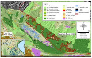
Forest Cover Map of Nakai Plateau, Laos
Aruna was contracted by NTPC to evaluate the change in forest cover in the Nakai Plateau in Southern Laos and the biomass of the area to be inundated within the plateau by the planned Nam Theun 2 hydropower project. Historical LandSAT imagery from 1973, 1989, 1996 and 2003 along with additional data including aerial photography and SPOT satellite imagery, GIS data, maps and reports were used to estimate the change in forest cover between the different time periods. The 2003 image was stratified and analyzed to better estimate the land cover categories in the inundation area to provide a basis for estimation of the biomass of the area to be flooded. Field sampling work and ground truthing on site verified the analyses and provided a basis for the estimation of the biomass based on land cover categories and areas. All results were presented in reports and maps as well as classified satellite imagery and GIS data on CDs to the client.


