Aruna Technology Ltd Aruna Technology Ltd
  • Products
    • eBee Drones
    • Garmin GPS
    • Garmin Map
    • GIS Software
    • Satellite Imagery
    • Trimble Survey Equipment
    • Haglöf Forest Inventory Solutions
  • Solutions
    • Forest & Land Cover Mapping
    • GIS Consultancy
    • Land Survey
    • Remote Sensing and Image Processing
    • Training
    • Web GIS
    • REDD and Forest Carbon
  • Who We Are
  • About Us
  • Blog
  • Contact
Dec 09

5 Reasons to Fly A Fixed Wing Drone

  • December 9, 2019
  • No Comments
  • Site News

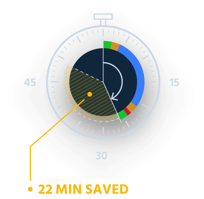
Reason # 1: Spend less time on-site

As the guide below proves, when flying a 100 ha (247 ac) mapping project, a fixed-wing senseFly eBee X drone can complete this job in 26 minutes, a saving of 22 minutes over a typical quadcopter system. Expand the project size further, up to 300 ha (741 ac), and using the senseFly eBee X reduces the time required on-site by a massive 90 minutes!

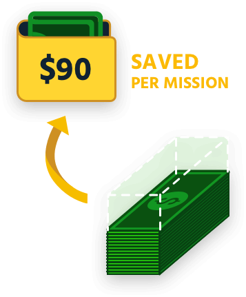
Reason #2: Reduce labour costs

Knowing how long you’re likely to spend on-site is essential to calculating the profitability of your mapping projects. Reason 2 of our guide takes the data from our previous section and translates that into real-world cost savings. Things get really exciting when you realize you can save up to USD $385 (per mapping mission) by flying a fixed-wing drone versus a quadcopter!

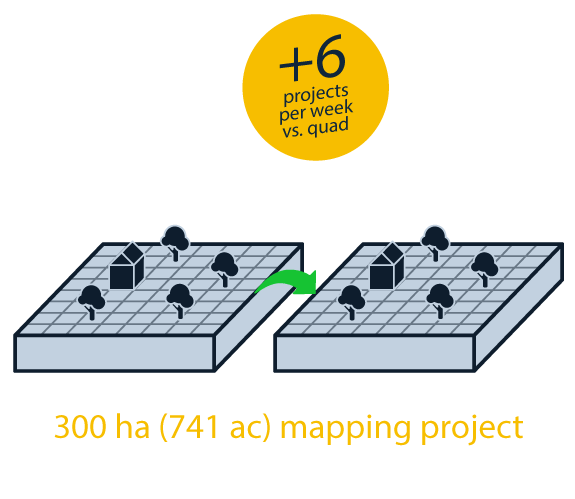
Reason #3: Increase your project capacity

Using a fixed-wing drone rather than a quadcopter not only helps you reduce your time on-site and cut labour costs, as Reasons 1 and 2 of our guide shows, it also helps you complete more missions per week. If you typically fly large 300 ha (741 ac) sites, flying a fixed-wing drone would be the difference between completing (and billing) for five projects versus eleven projects! Explore the stats below

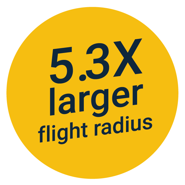
Reason #4: Access and map sites from farther away

The senseFly eBee X greatly expands your remote mapping capabilities by letting you remotely access and map sites that are farther away. When mapping a 40 ha (99 ac) site, for example, the zone from which you can successfully take off and land is over five times larger with an eBee X versus a quadcopter!

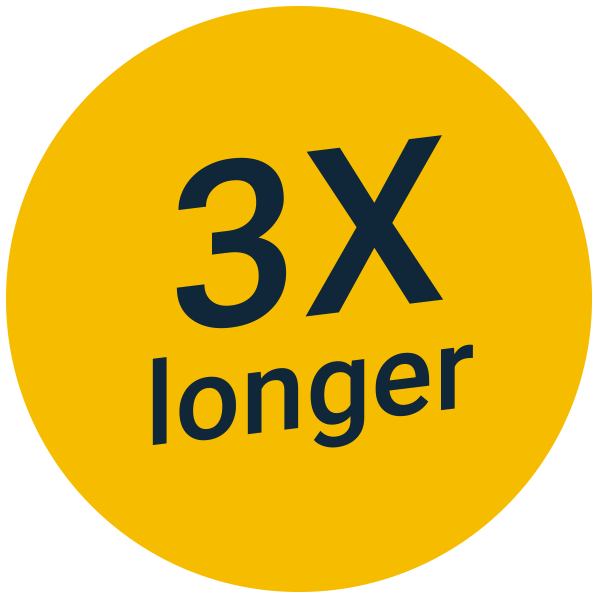
Reason #5: Map corridors with greater efficiency

The senseFly eBee X greatly enhances your corridor mapping capabilities. For example, with a senseFly eBee X fixed-wing drone, you can map a 28-kilometer (18 miles) corridor flying at a height of 400 feet (120 meters) versus just nine kilometers (5.6 miles) with a typical quadcopter – that’s up to 3x longer!

Want to learn more? Click here to download the full guide or Contact Us

  • Facebook
  • Twitter
  • Reddit
  • Pinterest
  • Google+
  • LinkedIn
  • E-Mail

About The Author

Leave a reply

Your email address will not be published. Required fields are marked *

SEARCH

Archives

  • April 2025
  • June 2024
  • April 2020
  • December 2019
  • September 2018
  • March 2014
  • September 2013
  • January 2013
  • December 2012
  • November 2012
  • September 2012
  • August 2012
  • June 2012
  • May 2012
  • April 2012
  • February 2012
  • November 2011
  • October 2011
  • September 2011
  • July 2011
  • June 2011
  • May 2011
  • April 2011
  • February 2011
  • January 2011
  • December 2010
  • November 2010
  • April 2010

Recent Comments

  • sathya LENG on Historical Maps of Phnom Penh
  • Maps of South East Asia | Walking in the Footsteps of Chang Noi on Garmin Map
  • sky on Using Khmer Unicode font with ArcGIS 10
  • Phalla Din on Equipment Donation to RUA
  • Phil on SPOT vs. SRTM DEM Comparison
© Aruna Technology. All rights reserved.