Aruna Technology Ltd Aruna Technology Ltd
  • Products
    • eBee Drones
    • Garmin GPS
    • Garmin Map
    • GIS Software
    • Satellite Imagery
    • Trimble Survey Equipment
    • Haglöf Forest Inventory Solutions
  • Solutions
    • Forest & Land Cover Mapping
    • GIS Consultancy
    • Land Survey
    • Remote Sensing and Image Processing
    • Training
    • Web GIS
    • REDD and Forest Carbon
  • Who We Are
  • About Us
  • Blog
  • Contact
Apr 03

Trimble GNSS for UXO Detection

  • April 3, 2025
  • No Comments
  • Site News

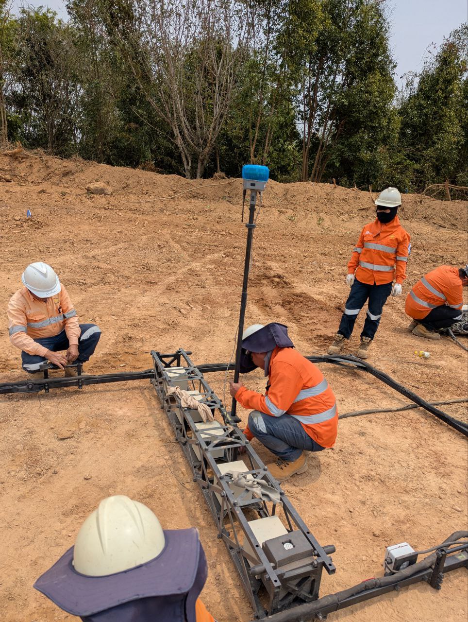
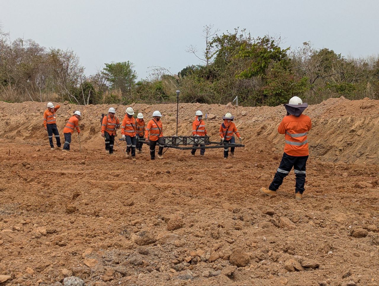
New Trimble R12i fitted to an UltraTEM-IV metal detector for unexploded ordnance (UXO) detection at the LXML Sepon mine site in Laos.

Michael Laneville, Senior Geophysicist,  LXML UXO Department, said “we were clearing UXO with different types of equipment depending on soil properties.

“This placed restrictions on mining below 1.25m in some areas. UltraTEM can detect UXO up to 2.5m in a single pass in all soil types, increasing speed and accuracy. I am very proud that LXML is using cutting-edge detection technology, providing safer, more efficient, UXO clearance solutions.”

Since 1996, LXML has invested US$52 million in UXO clearance and destroyed nearly 60,000 items, of which 90% of these are UXOs. In 2021 alone, 1,368 unsafe items were destroyed and over 7 million square metres of land was cleared of UXO.

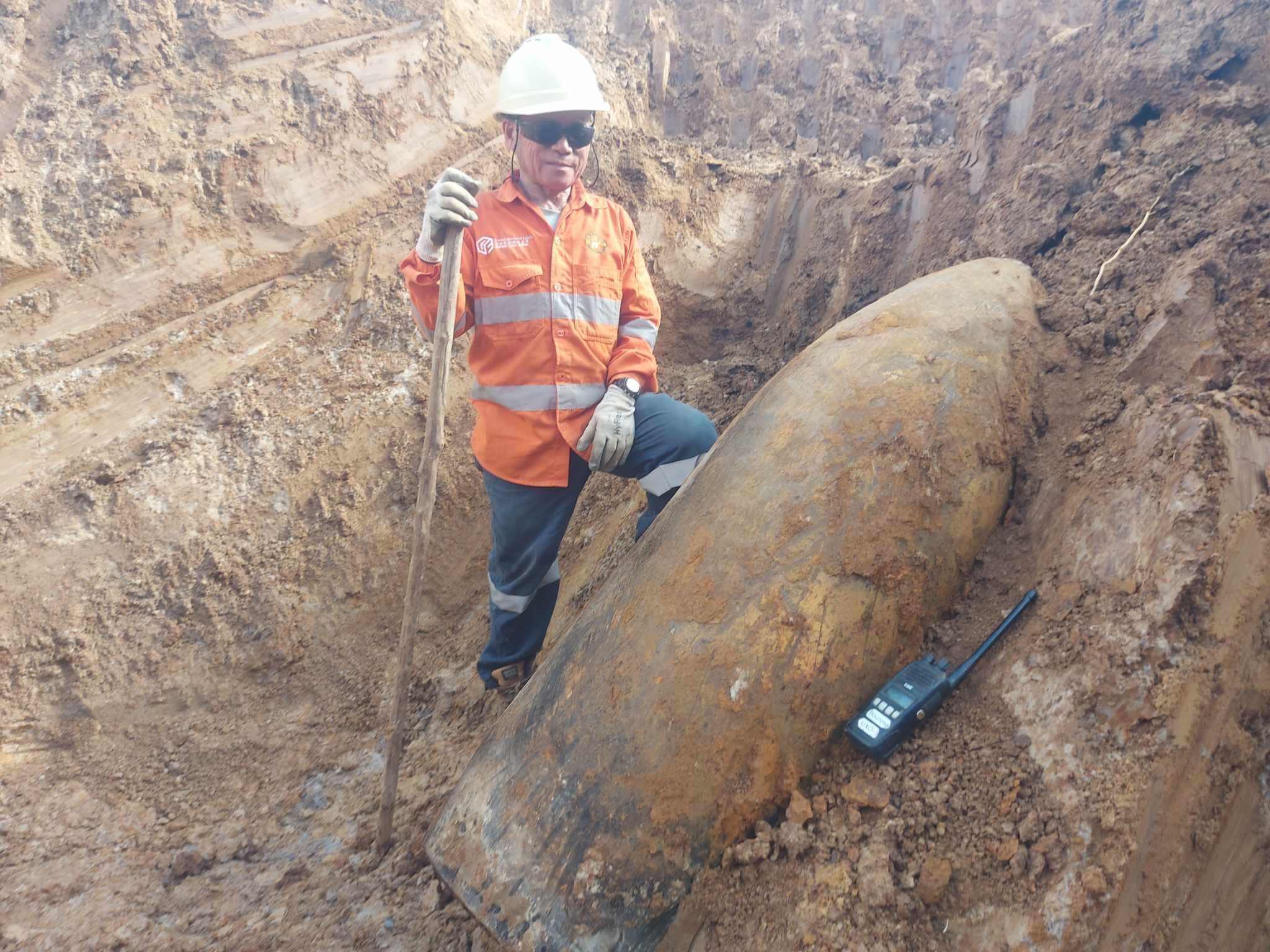
First photo is an unexploded 750 lb bomb, at a depth of 3m. Photo credit Palivath Inthavong.

  • Facebook
  • Twitter
  • Reddit
  • Pinterest
  • Google+
  • LinkedIn
  • E-Mail

About The Author

Leave a reply

Your email address will not be published. Required fields are marked *

SEARCH

Archives

  • April 2025
  • June 2024
  • April 2020
  • December 2019
  • September 2018
  • March 2014
  • September 2013
  • January 2013
  • December 2012
  • November 2012
  • September 2012
  • August 2012
  • June 2012
  • May 2012
  • April 2012
  • February 2012
  • November 2011
  • October 2011
  • September 2011
  • July 2011
  • June 2011
  • May 2011
  • April 2011
  • February 2011
  • January 2011
  • December 2010
  • November 2010
  • April 2010

Recent Comments

  • sathya LENG on Historical Maps of Phnom Penh
  • Maps of South East Asia | Walking in the Footsteps of Chang Noi on Garmin Map
  • sky on Using Khmer Unicode font with ArcGIS 10
  • Phalla Din on Equipment Donation to RUA
  • Phil on SPOT vs. SRTM DEM Comparison
© Aruna Technology. All rights reserved.