Aruna Technology Ltd Aruna Technology Ltd
  • Products
    • eBee Drones
    • Garmin GPS
    • Garmin Map
    • GIS Software
    • Satellite Imagery
    • Trimble Survey Equipment
    • Haglöf Forest Inventory Solutions
  • Solutions
    • Forest & Land Cover Mapping
    • GIS Consultancy
    • Land Survey
    • Remote Sensing and Image Processing
    • Training
    • Web GIS
    • REDD and Forest Carbon
  • Who We Are
  • About Us
  • Blog
  • Contact
Feb 11

De-Classified 60’s Imagery of Cambodia

  • February 11, 2012
  • 1 Comment
  • Site News

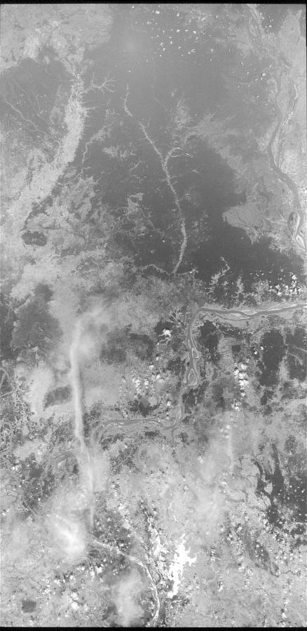
I initially got pretty excited by this discovery on http://earthexplorer.usgs.gov/ as some of the imagery is 2-4 ft in resolution and dates from the mid-60’s to mid-70’s. It was de-classified in two batches; 1996 and 2002. However, it seems that most of the imagery is quite cloudy (coincidence ?) and there is not much of the 2-4 ft stuff. Additional frustrations are that is costs money (alebeit a small amount – around $30) and cannot be downloaded. But anyone determined enough should be able to their hands on this.

I’m sure there a much larger collections that are not yet de-classified, covering the entire Khmer Rouge period in Cambodia. I wonder why.


Sceenshot of Black and white KH-7 High Resolution Surveillance Photo North of Phnom Penh. Image Date: 1967/05/24. Camera Resolution: 2 to 4 feet


Screen shot of image covering parts of Kampong Thom and Kampong Cham. Acquisition Date: 17-JAN-76. Camera Resolution: 20 to 30 feet.

  • Facebook
  • Twitter
  • Reddit
  • Pinterest
  • Google+
  • LinkedIn
  • E-Mail

About The Author

1 Comment

  1. Earth Explorer Cambodia « City of Water
    February 22, 2012 at 12:44 pm ·

    […] Hypothetically this could be really amazing. I’m not doing very well with the website interface though. Here are some images gathered through the site by Aruna Technology of De-Classified 60′s Imagery. […]

Leave a reply

Your email address will not be published. Required fields are marked *

SEARCH

Archives

  • April 2025
  • June 2024
  • April 2020
  • December 2019
  • September 2018
  • March 2014
  • September 2013
  • January 2013
  • December 2012
  • November 2012
  • September 2012
  • August 2012
  • June 2012
  • May 2012
  • April 2012
  • February 2012
  • November 2011
  • October 2011
  • September 2011
  • July 2011
  • June 2011
  • May 2011
  • April 2011
  • February 2011
  • January 2011
  • December 2010
  • November 2010
  • April 2010

Recent Comments

  • sathya LENG on Historical Maps of Phnom Penh
  • Maps of South East Asia | Walking in the Footsteps of Chang Noi on Garmin Map
  • sky on Using Khmer Unicode font with ArcGIS 10
  • Phalla Din on Equipment Donation to RUA
  • Phil on SPOT vs. SRTM DEM Comparison
© Aruna Technology. All rights reserved.