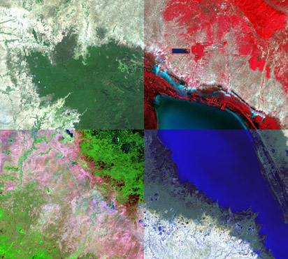
Remote sensing systems provide a repetitive and consistent view of the Earth that is invaluable to monitoring the Earth system and the effect of human activities on the Earth.
")
Important applications of remote sensing and imaging include:
- Environmental assessment and monitoring
- Forest Carbon Assessment
- Change detection and monitoring
- Agriculture
- Non-renewable resource exploration
- Renewable natural resources
- Meteorology
- Mapping
- Military surveillance and reconnaissance
- News media
Image processing may be considered to be the act of turning the raw data into useful and meaningful information. Image processing allows digital image data to be displayed, enhanced, analyzed or output in colour or grey scale format.
- Enhancing the features of interest
- Changing the image geometry
- Extracting patterns
- Removing noise
- Reducing data volume
Image Interpretation / Classification
Known as the automatic assignment of pixels in an image into land cover classes of themes, imagery can be classified spectrally, spatially and temporally. By comparing pixels to one another, it is possible to assemble groups of similar pixels into classes that match the categories of interest to a user. The values presented to the computer to characterize any one pixel corresponds to the amount of energy radiated, that is, reflected or emitted from a ground area and capture by the scanners instantaneous field of view. These classes form regions on a map or image.
Formation of GIS Data Layers
Once an image has been classified into more manageable classes or categories, it is a relatively simple process to convert these “groupings of similar pixels’ into vector data layers for use in a GIS. This process can be automated, or the imagery can be used as a backdrop for digitizing.
Land Use Mapping
Using either aerial photographs or high resolution satellite imagery in combination with existing hardcopy or GIS data sources, Aruna Technology Ltd. has much experience in the production of land use maps. This is achieved through the deployment of a field team to the study region, such that field-checking activities result in the most up-to-date and accurate value added land use maps.
Tonle Sap